The Geodienst: Viking swords, journalistic scoops, and cholera
The University of Groningen’s Geodienst recently celebrated its 10th anniversary. In this article, we look back on highlights, including journalistic scoops, large-scale projects, and the early years. ‘In the first year, we cheered every time an email came in.’
Text: Jelle Posthuma
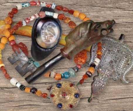
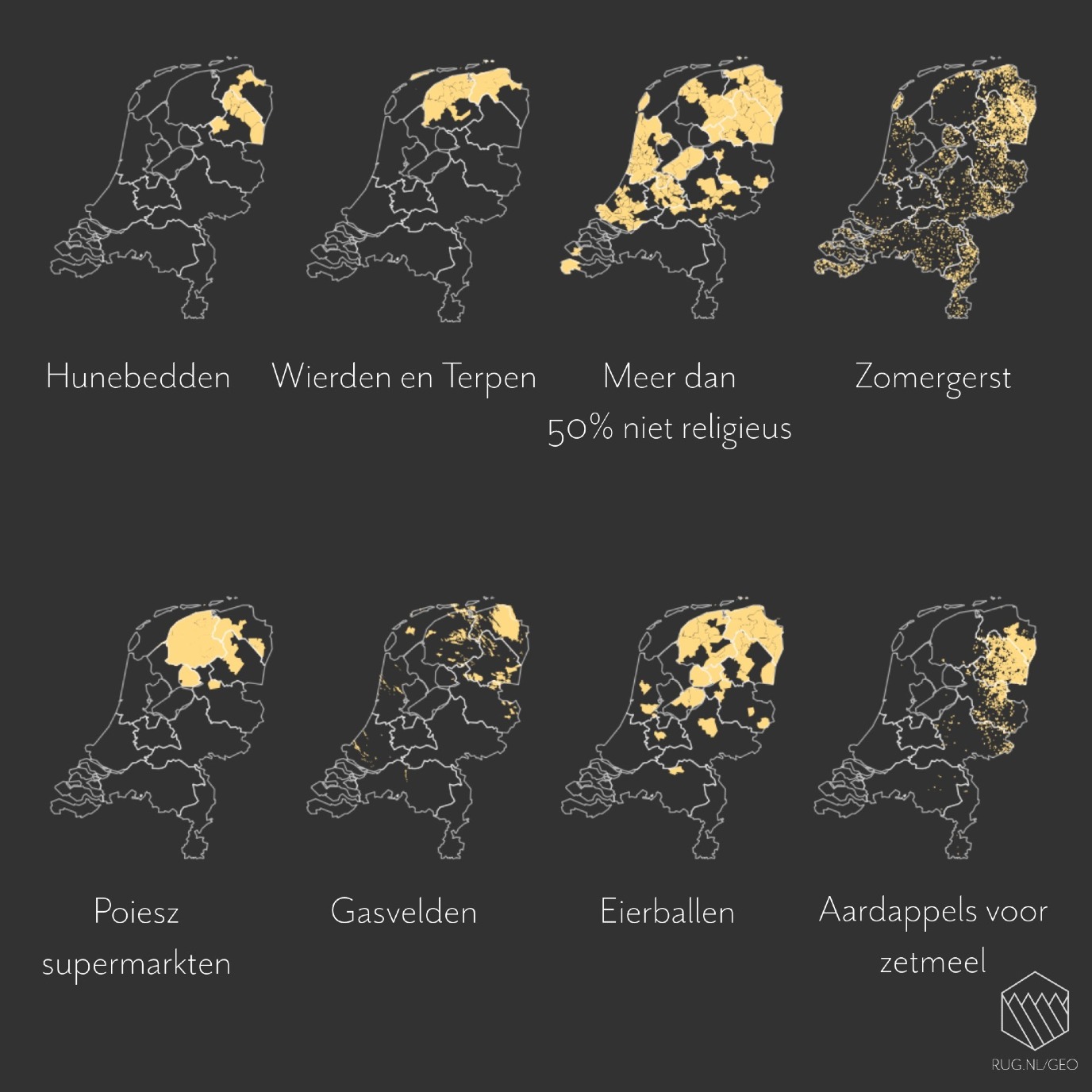
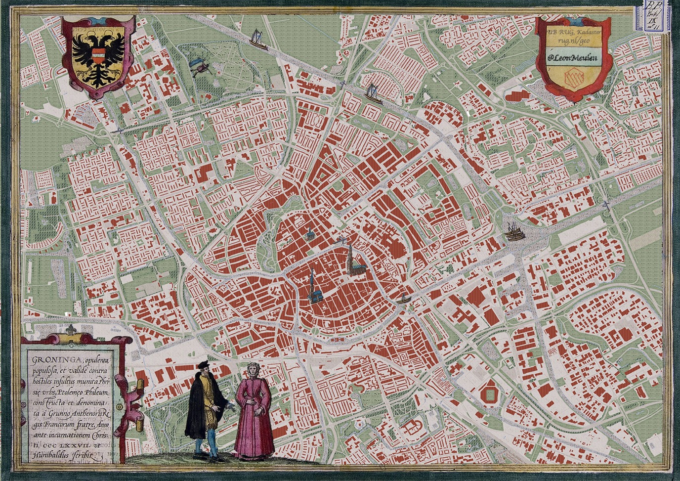
The Geodienst is a specialist in displaying spatial data—and a successful one at that. Projects regularly make the news, as did a recent high-profile report on a piece of Viking sword in Friesland. The unique find has been included in the Portable Antiquities Netherlands (PAN) database, according to Paul Haan, GIS specialist and geodata manager at the Geodienst. The PAN is a typical example of the department’s successful work. Its work includes mapping metal-detector finds in the Netherlands. It now contains more than 100,000 items. ‘The Vrije Universiteit Amsterdam (VU) and the National Agency for Cultural Heritage wanted to create this database. We ultimately built it’.
On the map thanks to social media
In the early days of the Geodienst, Haan and his colleagues gave many presentations at faculties and visualized datasets, which they then shared on social media. These reports attracted considerable attention. Haan grins, noting, ‘Sometimes, UG researchers discover through social media that the Geodienst exists and is part of the University. We get noticed through these channels and, as a result, journalists and others know where to find us’.
Journalistic scoops
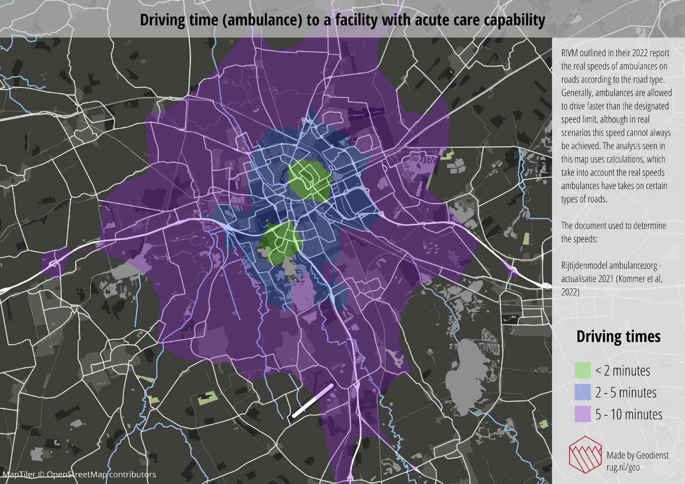
An example of cooperation with the media took place with Dutch news service RTL Nieuws in an investigation on ambulance response times. One striking result was that there are substantial ‘accessibility gaps’ in the Netherlands, where the ambulance is not able to arrive on time. Another collaboration focused on legislation concerning high-voltage power lines: construction around them was prohibited due to radiation, which potentially carried a risk of childhood cancer. ‘We investigated where active housing-construction projects were being carried out within a given radius of high-voltage power lines. It turned out that construction is nevertheless taking place in various locations in the Netherlands’. Yet another example is the Nieuwbouwmonitor, an online application that provides insight into the total amount of newbuild construction sites at the national and municipal scale. Haan explains, ‘Researchers and journalists are always in the lead regarding what they want to find out, and we provide the data and methodology to support their search’. The Geodienst will soon be launching a new project, known as RUGmaps: a Google Maps app for the buildings of the University of Groningen. Some University spaces are difficult to find. This app will make it easy for users to find their way around.
Demand for spatial data support
The Geodienst has existed since summer 2014. The service started as a one-year pilot project within the Center for Information Technology (CIT). ‘Before then, the Faculty of Spatial Sciences had handed out CDs with a licence code for geographic information systems. Demand for spatial data support kept increasing, however, including from other faculties’. The Geodienst was created to meet this demand. The first year was pioneering, recalls Haan. ‘It started with one team lead, one administrator, and two student assistants. I started as the third student assistant after six months. In the first year, we cheered every time an email came in: there was another question; people wanted something from us again.’
Cholera outbreak
The Geodienst is largely concerned with geographic information systems (GIS) and data management. ‘A GIS is an application for creating maps. The programme positions data on a map, allowing you to relate data and locations’. Haan presents an historical example to explain the importance of this relationship. ‘The British scientist John Snow investigated a cholera outbreak in London in the early 19th century. Snow closely tracked where the people who died of cholera lived, and discovered a geographical clustering. He then managed to relate this fact to a specific well, from which people in the area drank. His conclusion was that people who used this well were more likely to get cholera. That’s combining data and location’.
University-wide
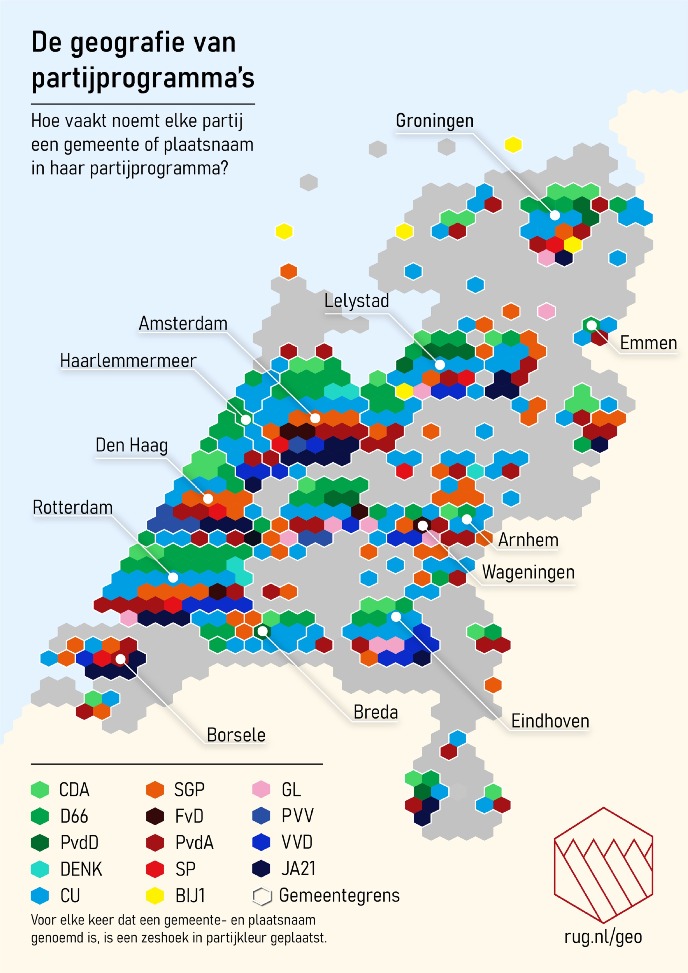
Haan adds that the Geodienst offers support to students and researchers with questions about datasets. It also provides technical assistance in the use of GIS applications. ‘We take care of the entire data life cycle: from finding or creating to editing, analysing, visualizing, and sharing’. One unique characteristic of the Geodienst is its University-wide design: at other Dutch universities, these services are limited to one or a few faculties. ‘By now, most researchers know how to find us’, notes Haan. ‘They include archaeologists, landscape historians, ecologists, economists, sociologists, and psychologists. For example, we participated in a study on how safe people feel due to the earthquakes in different areas of Groningen. There was a clear relationship between decline in housing values and the areas where people felt unsafe’.
Anniversary celebration
The anniversary celebration took place at the end of last year in the House of Connections, with several speakers, an information market, and closing drinks. The day was organized in collaboration with the Jantina Tammes School of Digital Society, Technology, and AI. This was no coincidence. Since early 2024, Govert Schoof, head of the Geodienst, has been the Liaison (point of contact) at the Jantina Tammes School. Meanwhile, the anniversary celebration is behind us. What will the next few years look like for the Geodienst? ‘Data usage will only become more important’, proposes Haan. ‘An important rule applies to data: garbage in, garbage out. If you put junk in, junk will also come out. You can see this in AI models, for example. Artificial intelligence has really taken off. How can you make sure that you are “feeding” good data to AI systems? There is a big role for us in that regard’.
User-friendly
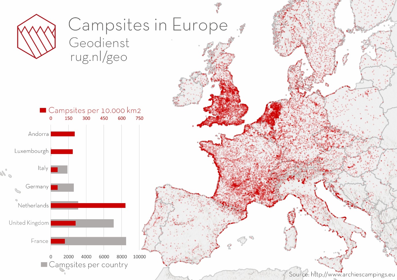
Above all, the Geodienst wants researchers and students to use spatial data. ‘We continue to promote this to all faculties of the UG. We have also noticed that researchers and students are increasingly working with data independently, due to the increase in user-friendliness. The old GIS applications had a very steep learning curve; now, you can make your own map with three clicks. As it becomes easier and easier to get started, the number of queries with us is only increasing. We are obviously happy to help with that.’
More information
-
See also: the map magician
| Last modified: | 17 January 2025 11.57 a.m. |
More news
-
24 March 2025
UG 28th in World's Most International Universities 2025 rankings
The University of Groningen has been ranked 28th in the World's Most International Universities 2025 by Times Higher Education. With this, the UG leaves behind institutions such as MIT and Harvard. The 28th place marks an increase of five places: in...
-
05 March 2025
Women in Science
The UG celebrates International Women’s Day with a special photo series: Women in Science.
-
16 December 2024
Jouke de Vries: ‘The University will have to be flexible’
2024 was a festive year for the University of Groningen. In this podcast, Jouke de Vries, the chair of the Executive Board, looks back.
